
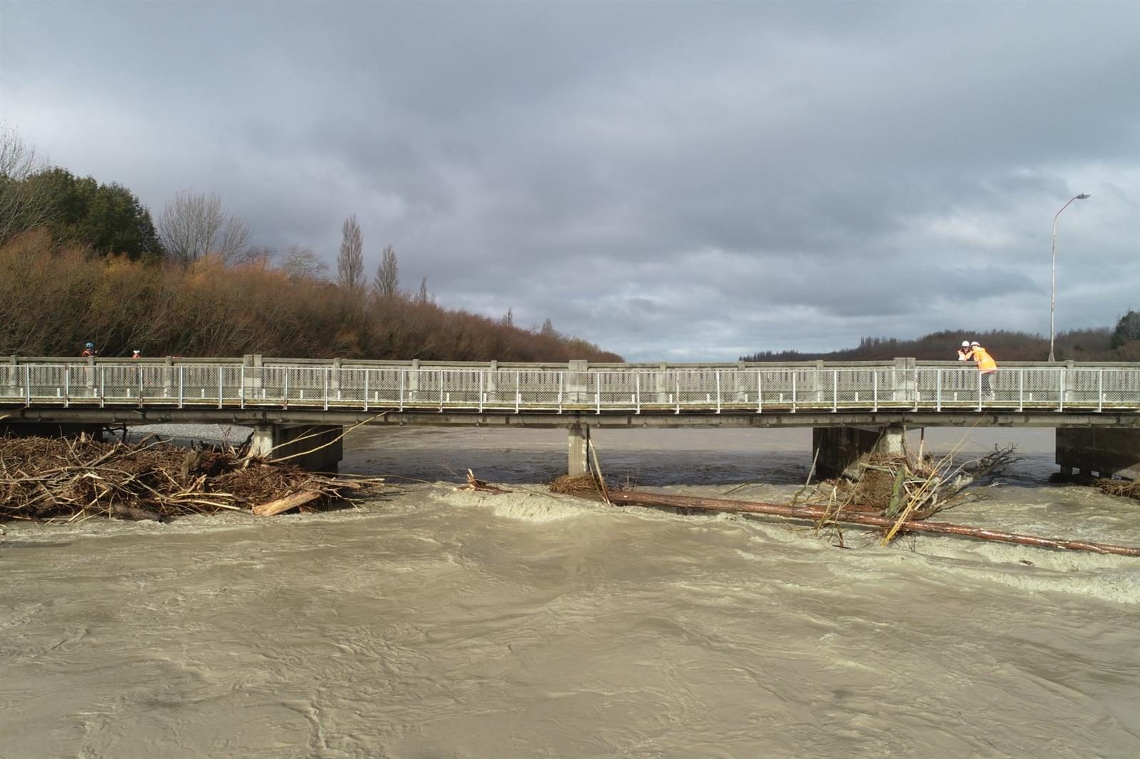
Transport links on State Highway 1 in the South Island were severely affected this week after extreme flooding in Canterbury resulted in the Ashburton River/ Hakatere Bridge being closed. The MetService said parts of inland Canterbury received half a metre of rain in the three days from Saturday to Monday.
The bridge across the Ashburton River on SH1 – the South Island’s main link road – was closed on 1 June after drivers reported slumping on the deck at the Ashburton end. The damage was caused by a build-up of debris in the river around the piers immediately to the north, and as flow dropped from 1500 cumecs to about 400 cumecs of water, debris got caught up in adjacent piers and all the water was directed to the pier that sustained the damage.
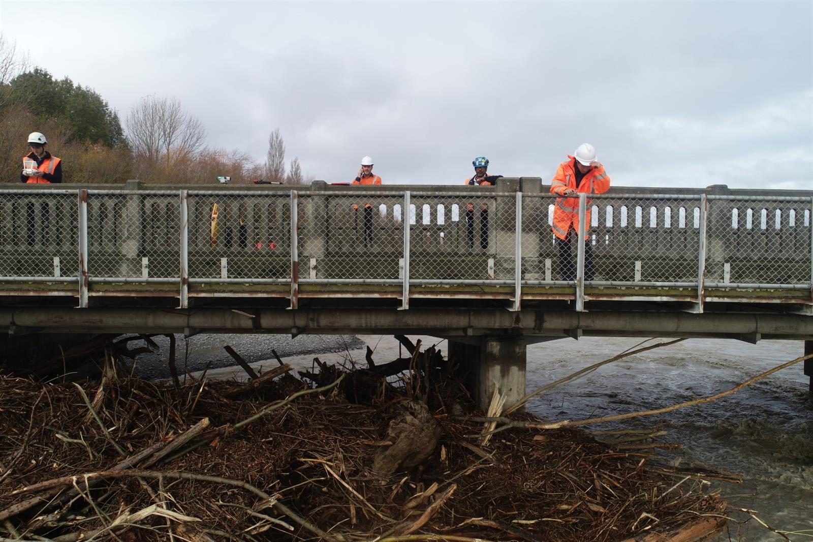
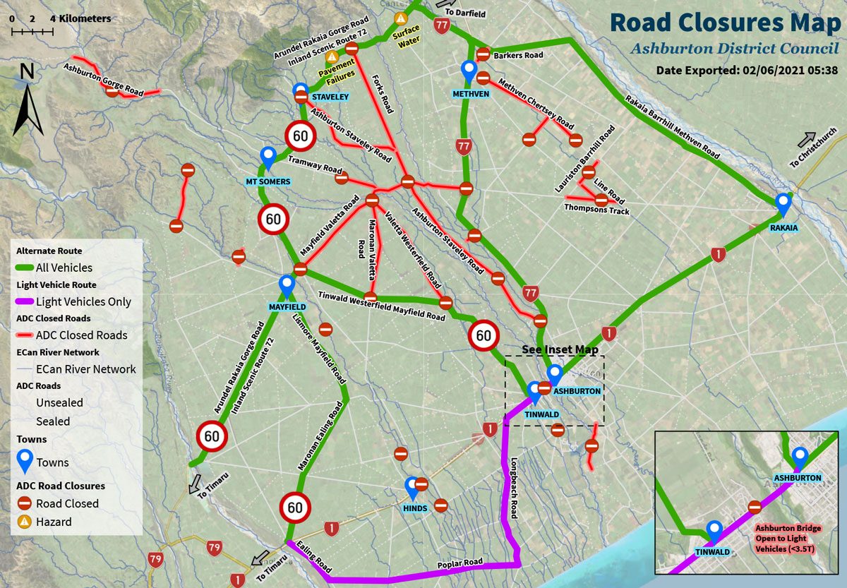
NZTA system manager Pete Connors, left, explains the stress loading systems used to test bridge piers to Ashburton District Council‘s emergency operations centre staff and Mayor Neil Brown.
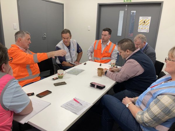
The NZ Transport Agency load tested the bridge that evening using a crane and 14-tonne weights. NZTA system manager Pete Connors said based on monitoring data received, the damaged pier, which sunk about 15cm during the recent one-in-100-year floods, was stable, and the bridge was able to take light traffic. He said NZTA‘s bridge engineers were working on the longer-term solutions for this bridge‘s pier.
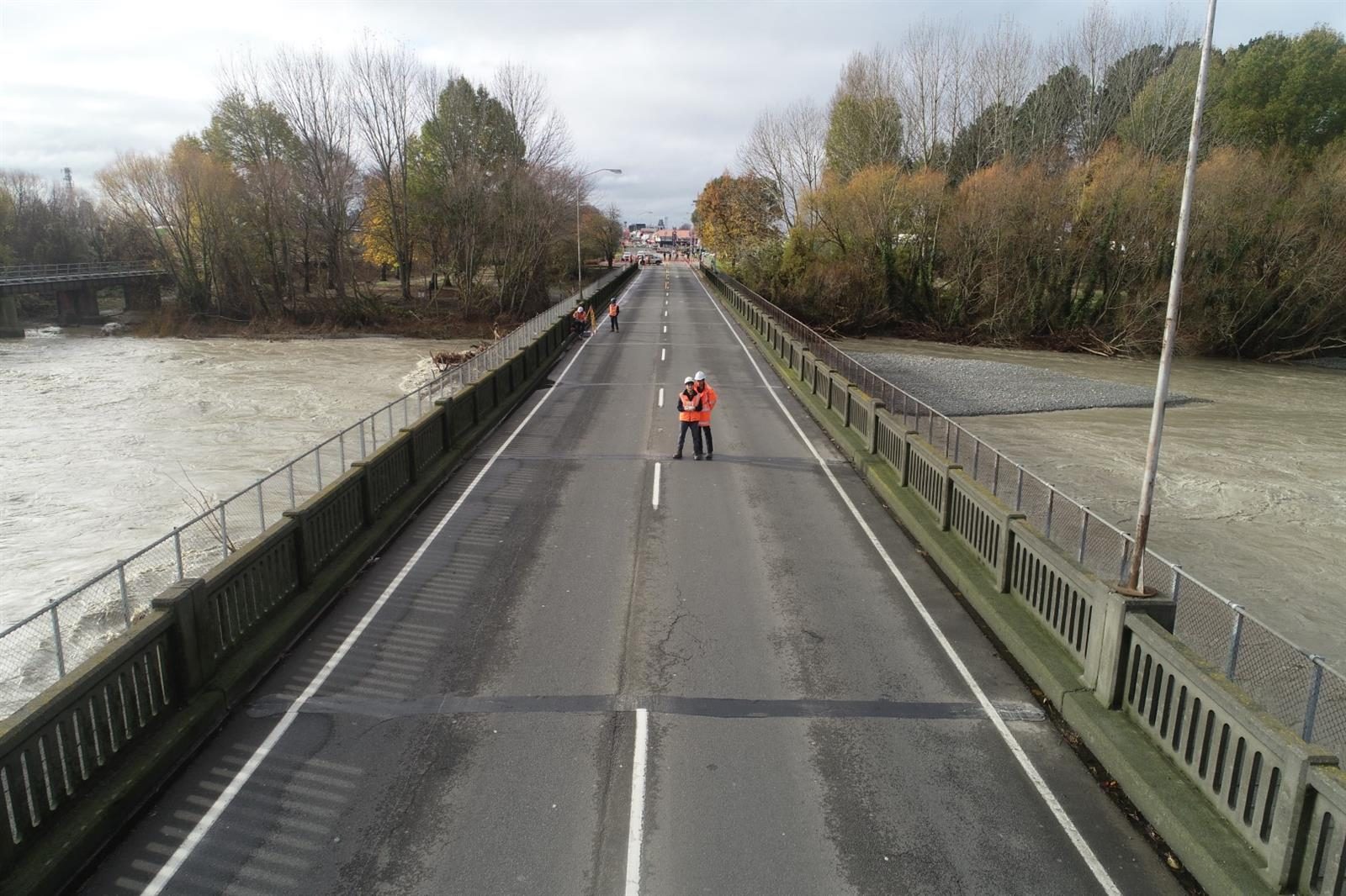
The bridge reopened for light traffic from 10pm on 1 June, with two-way traffic restricted to 30kph in each direction, but closed again on 2 June while load testing for heavier traffic (trucks) was carried out. Following that testing, the bridge reopened to light traffic again from 2.30pm, but will close again between 6pm and 8pm tonight for further inspections.
“We need two more hours of testing tonight to decide if trucks will be allowed on the bridge alongside light traffic, like cars,” said Connors.
“Once we have this information, we will be in a good position tomorrow to make a decision on the truck access.”
After 8pm, the bridge will still be restricted to light vehicles only.
During the testing NZTA staff took heavy trucks across the bridge carrying up to 40 tonnes of load to measure deflections.
The bridge closure has resulted in huge disruption to supply chains, with lengthy detours in place for trucks.
Heavy vehicles are being directed via SH77 to Methven and onto the Inland Scenic Route 72 to get through the district. The detour adds significant time to usual travel times, and drivers should expect delays. Ashburton Council is encouraging people to avoid non-essential travel at this time.
Connors said many roads need patching and repairs after being under water and damaged by debris for 48 hours, and there would be temporary speed limits in several places around the Canterbury region while crews undertake that work.
McLellan Transport general manager Alex McLellan said they hadn‘t been affected too much by the bridge closure.
“We traditionally just travel as far as Timaru. We do run product north, but we use an associate company to do that, so while we did experience some difficulty, we were able to pre-empt the opening of the bypass – by the time we got there it was open and we were able to keep our clients‘ needs met. There were others who were affected but for us it was just business as usual.‘
Mayfield Transport general manager Jim Crouchley said while there were some things the business had to stop doing, they managed to carry on with their herd shifting and stock cartage.
“There‘s a bit of flooding and stuff that‘s made it a bit challenging, but apart from that it‘s been okay. There are some farmers that have been really heavily affected with fences down and all sorts of stuff.”
Jim said he lives on a normally quiet country road near Ashburton but it wasn‘t so quiet once the traffic was diverted due to the bridge closure.
“We‘re on SH72, the Inland Scenic Route, that passes through Mayfield, where we‘re based. We had all the number one highway traffic going past the gateway until about 8.30pm when they opened another route diverting them through Methven.”
Mayfield Transport dispatch manager Mike Farnell said they had been lucky with their shifts, having done all the over-the-river shifts the previous week.
“I probably fielded more calls from other companies trying to get through our area yesterday than I made calls to our clients. It‘s been a little hectic; we‘ve done probably a quarter more ks than we normally would have. It‘s not too bad for us, but there were a few trips that should have taken three-quarters of an hour that were taking an hour and a half.”
Mike said it would be interesting to see if anything was done to patch the roads following the flooding.
“There‘s been some damage because the roads got quite soft with all-day torrential rain sitting on both sides of the road. And now with the number one state highway going through Mayfield, they‘re getting wrecked pretty quick. The roads in our county are pretty shocking to start with, and like a lot of other people, we‘ve got an issue with our road user charges not being spent in the right places. It‘s a bit frustrating when you see all the projects going on – if we could spend our road user charges where we actually earned them I think we‘d all be better off.”
Highway update as at 2 June
Closed:
SH1 Hinds River Bridge between William St and Lynnford Rd
SH73 Springfield to Castle Hill (including Porter River Bridge washout). Next update due by 12pm, June 3.
Caution:
SH1 Norwood to Dunsandel: Now open to one lane under stop/go traffic management and a 30kmh temporary speed restriction in place.
SH1 Ashburton near Saunders Rd (flooding)
SH1/SH8 Timaru to Fairlie (flooding)
SH77 Darfield to Mount Hutt: now open to one lane under stop/go traffic management with temporary speed restrictions in place in various locations
SH79 Geraldine to Rangitata (flooding)
SH8 Fairlie to Tekapo, Burkes Pass (flooding)
SH82 Station Peak (flooding)